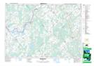
Maps showing Oxford, Grenville, Ontario
Oxford is a Geographical area located in Grenville, Ontario.
- Latitude: 44° 57' 44'' North (decimal: 44.9622222)
- Longitude: 75° 40' 37'' West (decimal: -75.6769444)
- Topography Feature Category: Geographical area
- Geographical Feature: Geographic Township
- Canadian Province/Territory: Ontario
- Location: Grenville
- Atlas of Canada Locator Map: Oxford
- GPS Coordinate Locator Map: Oxford Lat/Long
Oxford NTS Map Sheets