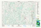
Maps showing Barrhead Mill Pond, Grey, Ontario
Barrhead Mill Pond is a Lake located in Grey, Ontario.
- Latitude: 44° 18' 9'' North (decimal: 44.3024999)
- Longitude: 80° 39' 46'' West (decimal: -80.6627777)
- Topography Feature Category: Lake
- Geographical Feature: Pond
- Canadian Province/Territory: Ontario
- Location: Grey
- Atlas of Canada Locator Map: Barrhead Mill Pond
- GPS Coordinate Locator Map: Barrhead Mill Pond Lat/Long
Barrhead Mill Pond NTS Map Sheets