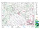
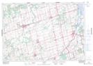
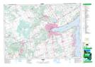
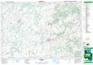
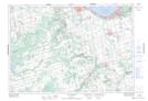
Maps showing Adjala-Tosorontio, Simcoe, Ontario
Adjala-Tosorontio is a Other municipal/district area - miscellaneous located in Simcoe, Ontario.
- Latitude: 44° 7' 56'' North (decimal: 44.1322222)
- Longitude: 79° 55' 56'' West (decimal: -79.9322222)
- Topography Feature Category: Other municipal/district area - miscellaneous
- Geographical Feature: Township Municipality
- Canadian Province/Territory: Ontario
- Location: Simcoe
- Atlas of Canada Locator Map: Adjala-Tosorontio
- GPS Coordinate Locator Map: Adjala-Tosorontio Lat/Long
Adjala-Tosorontio NTS Map Sheets
030M13 Bolton Topographic Map at 1:50,000 scale
031D04 Alliston Topographic Map at 1:50,000 scale
031D05 Barrie Topographic Map at 1:50,000 scale
041A01 Dundalk Topographic Map at 1:50,000 scale
041A08 Collingwood Topographic Map at 1:50,000 scale
030M Toronto Topographic Map at 1:250,000 scale
031D Lake Simcoe Topographic Map at 1:250,000 scale
041A Owen Sound Topographic Map at 1:250,000 scale