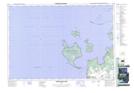
Maps showing Baie du Tonnerre, Simcoe, Ontario
Baie du Tonnerre is a Bay located in Simcoe, Ontario.
- Latitude: 44° 49' North (decimal: 44.8167000)
- Longitude: 80° 4' West (decimal: -80.0667000)
- Topography Feature Category: Bay
- Geographical Feature: Baie
- Canadian Province/Territory: Ontario
- Location: Simcoe
- Atlas of Canada Locator Map: Baie du Tonnerre
- GPS Coordinate Locator Map: Baie du Tonnerre Lat/Long
Baie du Tonnerre NTS Map Sheets