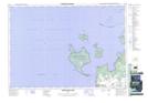
Maps showing Île au Géant, Simcoe, Ontario
Île au Géant is a Island located in Simcoe, Ontario.
- Latitude: 44° 54' North (decimal: 44.9000000)
- Longitude: 80° 11' West (decimal: -80.1833000)
- Topography Feature Category: Island
- Geographical Feature: Île / Ile
- Canadian Province/Territory: Ontario
- Location: Simcoe
- Atlas of Canada Locator Map: Île au Géant
- GPS Coordinate Locator Map: Île au Géant Lat/Long
Île au Géant NTS Map Sheets