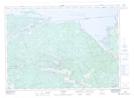
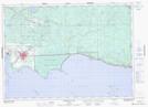
Maps showing Îles Manitou, Nipissing, Ontario
Îles Manitou is a Island located in Nipissing, Ontario.
- Latitude: 46° 15' North (decimal: 46.2500000)
- Longitude: 79° 35' West (decimal: -79.5832999)
- Topography Feature Category: Island
- Geographical Feature: Îles / Iles
- Canadian Province/Territory: Ontario
- Location: Nipissing
- Atlas of Canada Locator Map: Îles Manitou
- GPS Coordinate Locator Map: Îles Manitou Lat/Long
Îles Manitou NTS Map Sheets