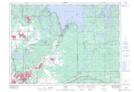
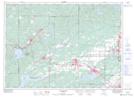
Maps showing Rivière de Whitson, Sudbury, Ontario
Rivière de Whitson is a River located in Sudbury, Ontario.
- Latitude: 46° 32' North (decimal: 46.5332999)
- Longitude: 81° 17' West (decimal: -81.2833000)
- Topography Feature Category: River
- Geographical Feature: Rivière
- Canadian Province/Territory: Ontario
- Location: Sudbury
- Atlas of Canada Locator Map: Rivière de Whitson
- GPS Coordinate Locator Map: Rivière de Whitson Lat/Long
Rivière de Whitson NTS Map Sheets