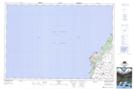
Maps showing Baie du Doré, Bruce, Ontario
Baie du Doré is a Unincorporated area located in Bruce, Ontario.
- Latitude: 44° 20' 5'' North (decimal: 44.3347222)
- Longitude: 81° 33' 9'' West (decimal: -81.5524999)
- Topography Feature Category: Unincorporated area
- Geographical Feature: Dispersed Rural Community
- Canadian Province/Territory: Ontario
- Location: Bruce
- Atlas of Canada Locator Map: Baie du Doré
- GPS Coordinate Locator Map: Baie du Doré Lat/Long
Baie du Doré NTS Map Sheets