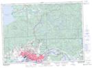
Maps showing Garden River 14, Algoma, Ontario
Garden River 14 is a Indian Reserve located in Algoma, Ontario.
- Latitude: 46° 33' 12'' North (decimal: 46.5533333)
- Longitude: 84° 6' 29'' West (decimal: -84.1080555)
- Topography Feature Category: Indian Reserve
- Geographical Feature: Indian Reserve - Réserve indienne
- Canadian Province/Territory: Ontario
- Location: Algoma
- Atlas of Canada Locator Map: Garden River 14
- GPS Coordinate Locator Map: Garden River 14 Lat/Long
Garden River 14 NTS Map Sheets