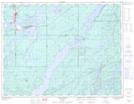
Maps showing Ginoogaming First Nation, Thunder Bay, Ontario
Ginoogaming First Nation is a Indian Reserve located in Thunder Bay, Ontario.
- Latitude: 49° 43' 53'' North (decimal: 49.7313888)
- Longitude: 86° 31' 1'' West (decimal: -86.5169443)
- Topography Feature Category: Indian Reserve
- Geographical Feature: Indian Reserve - Réserve indienne
- Canadian Province/Territory: Ontario
- Location: Thunder Bay
- Atlas of Canada Locator Map: Ginoogaming First Nation
- GPS Coordinate Locator Map: Ginoogaming First Nation Lat/Long