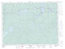
Maps showing Pic Mobert Reserve South, Thunder Bay, Ontario
Pic Mobert Reserve South is a Indian Reserve located in Thunder Bay, Ontario.
- Latitude: 48° 41' 11'' North (decimal: 48.6863888)
- Longitude: 85° 38' 38'' West (decimal: -85.6438888)
- Topography Feature Category: Indian Reserve
- Geographical Feature: Indian Reserve - Réserve indienne
- Canadian Province/Territory: Ontario
- Location: Thunder Bay
- Atlas of Canada Locator Map: Pic Mobert Reserve South
- GPS Coordinate Locator Map: Pic Mobert Reserve South Lat/Long
Pic Mobert Reserve South NTS Map Sheets