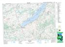
Maps showing Alderville First Nation, Northumberland, Ontario
Alderville First Nation is a Indian Reserve located in Northumberland, Ontario.
- Latitude: 44° 10' 35'' North (decimal: 44.1763888)
- Longitude: 78° 4' 24'' West (decimal: -78.0733333)
- Topography Feature Category: Indian Reserve
- Geographical Feature: Indian Reserve - Réserve indienne
- Canadian Province/Territory: Ontario
- Location: Northumberland
- Atlas of Canada Locator Map: Alderville First Nation
- GPS Coordinate Locator Map: Alderville First Nation Lat/Long
Alderville First Nation NTS Map Sheets