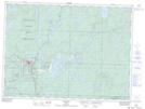
Maps showing Chapleau 61, Sudbury, Ontario
Chapleau 61 is a Indian Reserve located in Sudbury, Ontario.
- Latitude: 47° 49' 58'' North (decimal: 47.8327776)
- Longitude: 83° 23' 11'' West (decimal: -83.3863888)
- Topography Feature Category: Indian Reserve
- Geographical Feature: Indian Reserve - Réserve indienne
- Canadian Province/Territory: Ontario
- Location: Sudbury
- Atlas of Canada Locator Map: Chapleau 61
- GPS Coordinate Locator Map: Chapleau 61 Lat/Long