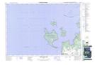
Maps showing Christian Island 30, Simcoe, Ontario
Christian Island 30 is a Indian Reserve located in Simcoe, Ontario.
- Latitude: 44° 50' 37'' North (decimal: 44.843611)
- Longitude: 80° 10' 54'' West (decimal: -80.1816666)
- Topography Feature Category: Indian Reserve
- Geographical Feature: Indian Reserve - Réserve indienne
- Canadian Province/Territory: Ontario
- Location: Simcoe
- Atlas of Canada Locator Map: Christian Island 30
- GPS Coordinate Locator Map: Christian Island 30 Lat/Long
Christian Island 30 NTS Map Sheets