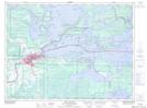
Maps showing Couchiching 16A, Rainy River, Ontario
Couchiching 16A is a Indian Reserve located in Rainy River, Ontario.
- Latitude: 48° 41' 17'' North (decimal: 48.6880555)
- Longitude: 93° 25' 34'' West (decimal: -93.426111)
- Topography Feature Category: Indian Reserve
- Geographical Feature: Indian Reserve - Réserve indienne
- Canadian Province/Territory: Ontario
- Location: Rainy River
- Atlas of Canada Locator Map: Couchiching 16A
- GPS Coordinate Locator Map: Couchiching 16A Lat/Long
Couchiching 16A NTS Map Sheets