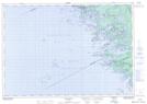
Maps showing Moose Point 79, Muskoka, Ontario
Moose Point 79 is a Indian Reserve located in Muskoka, Ontario.
- Latitude: 45° 4' 49'' North (decimal: 45.0802778)
- Longitude: 80° 1' 59'' West (decimal: -80.0330555)
- Topography Feature Category: Indian Reserve
- Geographical Feature: Indian Reserve - Réserve indienne
- Canadian Province/Territory: Ontario
- Location: Muskoka
- Atlas of Canada Locator Map: Moose Point 79
- GPS Coordinate Locator Map: Moose Point 79 Lat/Long
Moose Point 79 NTS Map Sheets