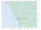
Maps showing Pic River 50, Thunder Bay, Ontario
Pic River 50 is a Indian Reserve located in Thunder Bay, Ontario.
- Latitude: 48° 37' 49'' North (decimal: 48.6302776)
- Longitude: 86° 16' 23'' West (decimal: -86.2730554)
- Topography Feature Category: Indian Reserve
- Geographical Feature: Indian Reserve - Réserve indienne
- Canadian Province/Territory: Ontario
- Location: Thunder Bay
- Atlas of Canada Locator Map: Pic River 50
- GPS Coordinate Locator Map: Pic River 50 Lat/Long