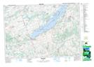
Maps showing SugarIsland 37A, Peterborough, Ontario
SugarIsland 37A is a Indian Reserve located in Peterborough, Ontario.
- Latitude: 44° 13' 7'' North (decimal: 44.2186111)
- Longitude: 78° 8' 16'' West (decimal: -78.1377776)
- Topography Feature Category: Indian Reserve
- Geographical Feature: Indian Reserve - Réserve indienne
- Canadian Province/Territory: Ontario
- Location: Peterborough
- Atlas of Canada Locator Map: SugarIsland 37A
- GPS Coordinate Locator Map: SugarIsland 37A Lat/Long
SugarIsland 37A NTS Map Sheets