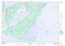
Maps showing Leeson Bay, Manitoulin, Ontario
Leeson Bay is a Bay located in Manitoulin, Ontario.
- Latitude: 45° 36' 21'' North (decimal: 45.6058333)
- Longitude: 81° 57' 28'' West (decimal: -81.9577777)
- Topography Feature Category: Bay
- Geographical Feature: Bay
- Canadian Province/Territory: Ontario
- Location: Manitoulin
- Atlas of Canada Locator Map: Leeson Bay
- GPS Coordinate Locator Map: Leeson Bay Lat/Long
Leeson Bay NTS Map Sheets