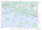
Maps showing Sagamok, Ontario
Sagamok is a Indian Reserve located in Ontario.
- Latitude: 46° 9' 31'' North (decimal: 46.1585196)
- Longitude: 82° 12' 41'' West (decimal: -82.2114398)
- Topography Feature Category: Indian Reserve
- Geographical Feature: Indian Reserve
- Canadian Province/Territory: Ontario
- Atlas of Canada Locator Map: Sagamok
- GPS Coordinate Locator Map: Sagamok Lat/Long
Sagamok NTS Map Sheets