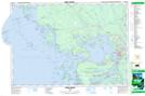
Maps showing Pioneer Island, Ontario
Pioneer Island is a Island located in Ontario.
- Latitude: 45° 29' 33'' North (decimal: 45.4924998)
- Longitude: 80° 26' 28'' West (decimal: -80.4411109)
- Topography Feature Category: Island
- Geographical Feature: Island
- Canadian Province/Territory: Ontario
- Atlas of Canada Locator Map: Pioneer Island
- GPS Coordinate Locator Map: Pioneer Island Lat/Long
Pioneer Island NTS Map Sheets