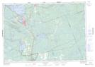
Maps showing Suttaby Bay, Muskoka, Ontario
Suttaby Bay is a Bay located in Muskoka, Ontario.
- Latitude: 44° 58' 29'' North (decimal: 44.9746999)
- Longitude: 79° 21' 55'' West (decimal: -79.3652999)
- Topography Feature Category: Bay
- Geographical Feature: Bay
- Canadian Province/Territory: Ontario
- Location: Muskoka
- Atlas of Canada Locator Map: Suttaby Bay
- GPS Coordinate Locator Map: Suttaby Bay Lat/Long
Suttaby Bay NTS Map Sheets