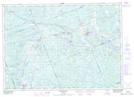
Maps showing Catfish Rock, Parry Sound, Ontario
Catfish Rock is a Cape located in Parry Sound, Ontario.
- Latitude: 45° 38' 59'' North (decimal: 45.6497221)
- Longitude: 79° 51' 30'' West (decimal: -79.8583333)
- Topography Feature Category: Cape
- Geographical Feature: Point
- Canadian Province/Territory: Ontario
- Location: Parry Sound
- Atlas of Canada Locator Map: Catfish Rock
- GPS Coordinate Locator Map: Catfish Rock Lat/Long
Catfish Rock NTS Map Sheets