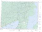
Maps showing Summer Island, Sibley, Ontario
Summer Island is a Island located in Sibley, Ontario.
- Latitude: 48° 30' 12'' North (decimal: 48.5032028)
- Longitude: 88° 38' 14'' West (decimal: -88.6373558)
- Topography Feature Category: Island
- Geographical Feature: Island
- Canadian Province/Territory: Ontario
- Location: Sibley
- Atlas of Canada Locator Map: Summer Island
- GPS Coordinate Locator Map: Summer Island Lat/Long