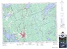
Maps showing Heney Creek, McLean, Ontario
Heney Creek is a River located in McLean, Ontario.
- Latitude: 45° 6' 53'' North (decimal: 45.1146328)
- Longitude: 79° 6' 55'' West (decimal: -79.1153118)
- Topography Feature Category: River
- Geographical Feature: Creek
- Canadian Province/Territory: Ontario
- Location: McLean
- Atlas of Canada Locator Map: Heney Creek
- GPS Coordinate Locator Map: Heney Creek Lat/Long
Heney Creek NTS Map Sheets