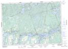
Maps showing Tate's Point, Harvey, Ontario
Tate's Point is a Cape located in Harvey, Ontario.
- Latitude: 44° 34' 28'' North (decimal: 44.5743879)
- Longitude: 78° 28' 23'' West (decimal: -78.4730450)
- Topography Feature Category: Cape
- Geographical Feature: Point
- Canadian Province/Territory: Ontario
- Location: Harvey
- Atlas of Canada Locator Map: Tate's Point
- GPS Coordinate Locator Map: Tate's Point Lat/Long
Tate's Point NTS Map Sheets