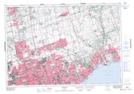
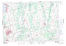
Maps showing Tannery Creek, York, Ontario
Tannery Creek is a River located in York, Ontario.
- Latitude: 44° 1' 24'' North (decimal: 44.0233333)
- Longitude: 79° 27' 45'' West (decimal: -79.4624999)
- Topography Feature Category: River
- Geographical Feature: Creek
- Canadian Province/Territory: Ontario
- Location: York
- Atlas of Canada Locator Map: Tannery Creek
- GPS Coordinate Locator Map: Tannery Creek Lat/Long
Tannery Creek NTS Map Sheets