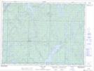
Maps showing Gowagamak Lake, Sudbury, Ontario
Gowagamak Lake is a Lake located in Sudbury, Ontario and has an elevation of 378 meters.
- Latitude: 47° 49' 50'' North (decimal: 47.8305555)
- Longitude: 82° 23' 32'' West (decimal: -82.3922222)
- Topography Feature Category: Lake
- Geographical Feature: Lake
- Canadian Province/Territory: Ontario
- Elevation: 378 meters
- Location: Sudbury
- Atlas of Canada Locator Map: Gowagamak Lake
- GPS Coordinate Locator Map: Gowagamak Lake Lat/Long