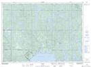
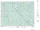
Maps showing Stobie Creek, Sudbury, Ontario
Stobie Creek is a River located in Sudbury, Ontario and has an elevation of 362 meters.
- Latitude: 46° 49' 8'' North (decimal: 46.8188888)
- Longitude: 80° 40' 24'' West (decimal: -80.6733333)
- Topography Feature Category: River
- Geographical Feature: Creek
- Canadian Province/Territory: Ontario
- Elevation: 362 meters
- Location: Sudbury
- Atlas of Canada Locator Map: Stobie Creek
- GPS Coordinate Locator Map: Stobie Creek Lat/Long
Stobie Creek NTS Map Sheets