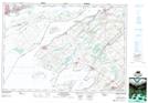
Maps showing Cataraqui River (Rideau Canal), Ontario
Cataraqui River (Rideau Canal) is a River located in Ontario and has an elevation of 79 meters.
- Latitude: 44° 14' 5'' North (decimal: 44.2347222)
- Longitude: 76° 28' 28'' West (decimal: -76.4744444)
- Topography Feature Category: River
- Geographical Feature: River
- Canadian Province/Territory: Ontario
- Elevation: 79 meters
- Atlas of Canada Locator Map: Cataraqui River (Rideau Canal)
- GPS Coordinate Locator Map: Cataraqui River (Rideau Canal) Lat/Long
Cataraqui River (Rideau Canal) NTS Map Sheets