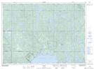
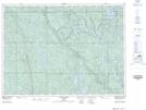
Maps showing Balsam Creek, Sudbury, Ontario
Balsam Creek is a River located in Sudbury, Ontario and has an elevation of 342 meters.
- Latitude: 46° 57' 47'' North (decimal: 46.9631000)
- Longitude: 80° 45' 10'' West (decimal: -80.7527999)
- Topography Feature Category: River
- Geographical Feature: Creek
- Canadian Province/Territory: Ontario
- Elevation: 342 meters
- Location: Sudbury
- Atlas of Canada Locator Map: Balsam Creek
- GPS Coordinate Locator Map: Balsam Creek Lat/Long
Balsam Creek NTS Map Sheets