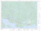
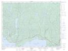
Maps showing Owl Creek, Thunder Bay, Ontario
Owl Creek is a River located in Thunder Bay, Ontario and has an elevation of 313 meters.
- Latitude: 48° 54' 50'' North (decimal: 48.9139000)
- Longitude: 87° 1' 20'' West (decimal: -87.0221999)
- Topography Feature Category: River
- Geographical Feature: Creek
- Canadian Province/Territory: Ontario
- Elevation: 313 meters
- Location: Thunder Bay
- Atlas of Canada Locator Map: Owl Creek
- GPS Coordinate Locator Map: Owl Creek Lat/Long
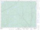
Owl Creek NTS Map Sheets