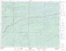
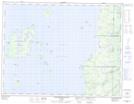
Maps showing Big Dawson Lake, Thunder Bay, Ontario
Big Dawson Lake is a Lake located in Thunder Bay, Ontario and has an elevation of 338 meters.
- Latitude: 49° 43' 40'' North (decimal: 49.7277999)
- Longitude: 88° 0' 0'' West (decimal: -88.0000000)
- Topography Feature Category: Lake
- Geographical Feature: Lake
- Canadian Province/Territory: Ontario
- Elevation: 338 meters
- Location: Thunder Bay
- Atlas of Canada Locator Map: Big Dawson Lake
- GPS Coordinate Locator Map: Big Dawson Lake Lat/Long
Big Dawson Lake NTS Map Sheets