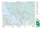
Maps showing Wahta Mohawk Territory, Muskoka, Ontario
Wahta Mohawk Territory is a Indian Reserve located in Muskoka, Ontario.
- Latitude: 45° 0' 59'' North (decimal: 45.0163888)
- Longitude: 79° 43' 49'' West (decimal: -79.7302777)
- Topography Feature Category: Indian Reserve
- Geographical Feature: Indian Reserve
- Canadian Province/Territory: Ontario
- Location: Muskoka
- Atlas of Canada Locator Map: Wahta Mohawk Territory
- GPS Coordinate Locator Map: Wahta Mohawk Territory Lat/Long
Wahta Mohawk Territory NTS Map Sheets