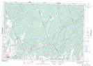
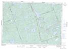
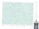
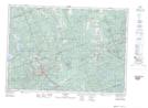
Maps showing Addington Highlands, Lennox and Addington, Ontario
Addington Highlands is a Other municipal/district area - miscellaneous located in Lennox and Addington, Ontario.
- Latitude: 44° 55' 53'' North (decimal: 44.9313888)
- Longitude: 77° 18' 47'' West (decimal: -77.3130555)
- Topography Feature Category: Other municipal/district area - miscellaneous
- Geographical Feature: Township Municipality
- Canadian Province/Territory: Ontario
- Location: Lennox and Addington
- Atlas of Canada Locator Map: Addington Highlands
- GPS Coordinate Locator Map: Addington Highlands Lat/Long
Addington Highlands NTS Map Sheets