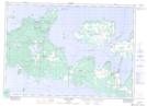
Maps showing Misery Bay Provincial Nature Reserve, Manitoulin, Ontario
Misery Bay Provincial Nature Reserve is a Conservation area located in Manitoulin, Ontario.
- Latitude: 45° 47' 40'' North (decimal: 45.7943999)
- Longitude: 82° 43' 30'' West (decimal: -82.7249999)
- Topography Feature Category: Conservation area
- Geographical Feature: Provincial Nature Reserve
- Canadian Province/Territory: Ontario
- Location: Manitoulin
- Atlas of Canada Locator Map: Misery Bay Provincial Nature Reserve
- GPS Coordinate Locator Map: Misery Bay Provincial Nature Reserve Lat/Long
Misery Bay Provincial Nature Reserve NTS Map Sheets