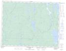
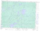
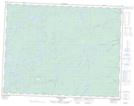
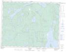
Maps showing Pantagruel Creek Provincial Nature Reserve, Thunder Bay, Ontario
Pantagruel Creek Provincial Nature Reserve is a Conservation area located in Thunder Bay, Ontario.
- Latitude: 49° 45' 15'' North (decimal: 49.7542000)
- Longitude: 89° 33' 0'' West (decimal: -89.5500000)
- Topography Feature Category: Conservation area
- Geographical Feature: Provincial Nature Reserve
- Canadian Province/Territory: Ontario
- Location: Thunder Bay
- Atlas of Canada Locator Map: Pantagruel Creek Provincial Nature Reserve
- GPS Coordinate Locator Map: Pantagruel Creek Provincial Nature Reserve Lat/Long
Pantagruel Creek Provincial Nature Reserve NTS Map Sheets