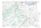
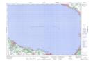
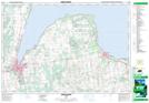
Maps showing Blue Mountains, Grey, Ontario
Blue Mountains is a Town located in Grey, Ontario.
- Latitude: 44° 28' 41'' North (decimal: 44.4780555)
- Longitude: 80° 24' 5'' West (decimal: -80.4013888)
- Topography Feature Category: Town
- Geographical Feature: Town
- Canadian Province/Territory: Ontario
- Location: Grey
- Atlas of Canada Locator Map: Blue Mountains
- GPS Coordinate Locator Map: Blue Mountains Lat/Long
Blue Mountains NTS Map Sheets