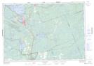
Maps showing Eleanor Island National Wildlife Area, Ontario
Eleanor Island National Wildlife Area is a Conservation area located in Ontario and has an elevation of 242 meters.
- Latitude: 44° 59' 00'' North (decimal: 44.9832999)
- Longitude: 79° 23' 30'' West (decimal: -79.3917000)
- Topography Feature Category: Conservation area
- Geographical Feature: National Wildlife Area
- Canadian Province/Territory: Ontario
- Elevation: 242 meters
- Atlas of Canada Locator Map: Eleanor Island National Wildlife Area
- GPS Coordinate Locator Map: Eleanor Island National Wildlife Area Lat/Long
Eleanor Island National Wildlife Area NTS Map Sheets