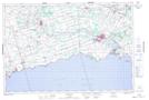
Maps showing Mohawk Island National Wildlife Area, Ontario
Mohawk Island National Wildlife Area is a Conservation area located in Ontario.
- Latitude: 42° 50' 00'' North (decimal: 42.8332999)
- Longitude: 79° 31' 30'' West (decimal: -79.5250000)
- Topography Feature Category: Conservation area
- Geographical Feature: National Wildlife Area
- Canadian Province/Territory: Ontario
- Atlas of Canada Locator Map: Mohawk Island National Wildlife Area
- GPS Coordinate Locator Map: Mohawk Island National Wildlife Area Lat/Long