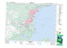
Maps showing Mission Island Marsh Conservation Area, Thunder Bay, Ontario
Mission Island Marsh Conservation Area is a Conservation area located in Thunder Bay, Ontario.
- Latitude: 48° 23' North (decimal: 48.3833000)
- Longitude: 89° 13' West (decimal: -89.2166999)
- Topography Feature Category: Conservation area
- Geographical Feature: Conservation Area
- Canadian Province/Territory: Ontario
- Location: Thunder Bay
- Atlas of Canada Locator Map: Mission Island Marsh Conservation Area
- GPS Coordinate Locator Map: Mission Island Marsh Conservation Area Lat/Long
Mission Island Marsh Conservation Area NTS Map Sheets