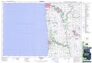
Maps showing Ashfield-Colborne-Wawanosh, Huron, Ontario
Ashfield-Colborne-Wawanosh is a Other municipal/district area - miscellaneous located in Huron, Ontario.
- Latitude: 43° 53' 16'' North (decimal: 43.8877777)
- Longitude: 81° 35' 38'' West (decimal: -81.5938888)
- Topography Feature Category: Other municipal/district area - miscellaneous
- Geographical Feature: Township Municipality
- Canadian Province/Territory: Ontario
- Location: Huron
- Atlas of Canada Locator Map: Ashfield-Colborne-Wawanosh
- GPS Coordinate Locator Map: Ashfield-Colborne-Wawanosh Lat/Long
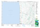
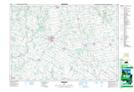
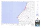
Ashfield-Colborne-Wawanosh NTS Map Sheets