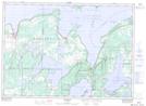
Maps showing Réserve Indienne 22 M'Chigeeng, Manitoulin, Ontario
Réserve Indienne 22 M'Chigeeng is a Indian Reserve located in Manitoulin, Ontario.
- Latitude: 45° 49' North (decimal: 45.8167000)
- Longitude: 82° 10' West (decimal: -82.1667000)
- Topography Feature Category: Indian Reserve
- Geographical Feature: Réserve indienne
- Canadian Province/Territory: Ontario
- Location: Manitoulin
- Atlas of Canada Locator Map: Réserve Indienne 22 M'Chigeeng
- GPS Coordinate Locator Map: Réserve Indienne 22 M'Chigeeng Lat/Long