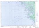
Maps showing Réserve indienne Chippewa Island, Muskoka, Ontario
Réserve indienne Chippewa Island is a Indian Reserve located in Muskoka, Ontario.
- Latitude: 45° 5' 20'' North (decimal: 45.0888890)
- Longitude: 80° 2' 25'' West (decimal: -80.0402780)
- Topography Feature Category: Indian Reserve
- Geographical Feature: Réserve indienne
- Canadian Province/Territory: Ontario
- Location: Muskoka
- Atlas of Canada Locator Map: Réserve indienne Chippewa Island
- GPS Coordinate Locator Map: Réserve indienne Chippewa Island Lat/Long
Réserve indienne Chippewa Island NTS Map Sheets