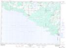
Maps showing Blue Jay Creek Provincial Park, Manitoulin, Ontario
Blue Jay Creek Provincial Park is a Conservation area located in Manitoulin, Ontario.
- Latitude: 45° 35' 30'' North (decimal: 45.5916999)
- Longitude: 82° 5' 00'' West (decimal: -82.0833000)
- Topography Feature Category: Conservation area
- Geographical Feature: Provincial Park
- Canadian Province/Territory: Ontario
- Location: Manitoulin
- Atlas of Canada Locator Map: Blue Jay Creek Provincial Park
- GPS Coordinate Locator Map: Blue Jay Creek Provincial Park Lat/Long
Blue Jay Creek Provincial Park NTS Map Sheets