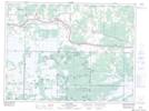
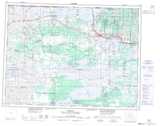
Maps showing Long Sault Indian Reserve 12, Rainy River, Ontario
Long Sault Indian Reserve 12 is a Indian Reserve located in Rainy River, Ontario.
- Latitude: 48° 38' 50'' North (decimal: 48.6472222)
- Longitude: 94° 6' 36'' West (decimal: -94.1100000)
- Topography Feature Category: Indian Reserve
- Geographical Feature: Indian Reserve
- Canadian Province/Territory: Ontario
- Location: Rainy River
- Atlas of Canada Locator Map: Long Sault Indian Reserve 12
- GPS Coordinate Locator Map: Long Sault Indian Reserve 12 Lat/Long