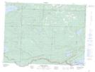
Maps showing Pigeon River Provincial Park, Thunder Bay, Ontario
Pigeon River Provincial Park is a Conservation area located in Thunder Bay, Ontario.
- Latitude: 48° 1' North (decimal: 48.016667)
- Longitude: 89° 35' West (decimal: -89.583333)
- Topography Feature Category: Conservation area
- Geographical Feature: Provincial Park
- Canadian Province/Territory: Ontario
- Location: Thunder Bay
- Atlas of Canada Locator Map: Pigeon River Provincial Park
- GPS Coordinate Locator Map: Pigeon River Provincial Park Lat/Long
Pigeon River Provincial Park NTS Map Sheets