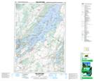
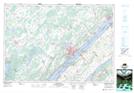
Maps showing Leeds and the Thousand Islands, Leeds, Ontario
Leeds and the Thousand Islands is a Other municipal/district area - miscellaneous located in Leeds, Ontario.
- Latitude: 44° 29' 12'' North (decimal: 44.4866666)
- Longitude: 76° 5' 33'' West (decimal: -76.0925000)
- Topography Feature Category: Other municipal/district area - miscellaneous
- Geographical Feature: Township Municipality
- Canadian Province/Territory: Ontario
- Location: Leeds
- Atlas of Canada Locator Map: Leeds and the Thousand Islands
- GPS Coordinate Locator Map: Leeds and the Thousand Islands Lat/Long
Leeds and the Thousand Islands NTS Map Sheets