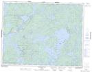
Maps showing Big Sand Lake Conservation Reserve, Kenora, Ontario
Big Sand Lake Conservation Reserve is a Conservation area located in Kenora, Ontario.
- Latitude: 50° 8' 40'' North (decimal: 50.1443999)
- Longitude: 94° 35' 20'' West (decimal: -94.5889000)
- Topography Feature Category: Conservation area
- Geographical Feature: Conservation Reserve
- Canadian Province/Territory: Ontario
- Location: Kenora
- Atlas of Canada Locator Map: Big Sand Lake Conservation Reserve
- GPS Coordinate Locator Map: Big Sand Lake Conservation Reserve Lat/Long
Big Sand Lake Conservation Reserve NTS Map Sheets