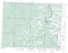
Maps showing Cedar Creek Conservation Reserve, Thunder Bay, Ontario
Cedar Creek Conservation Reserve is a Conservation area located in Thunder Bay, Ontario.
- Latitude: 48° 26' 30'' North (decimal: 48.4417000)
- Longitude: 89° 44' 30'' West (decimal: -89.7417000)
- Topography Feature Category: Conservation area
- Geographical Feature: Conservation Reserve
- Canadian Province/Territory: Ontario
- Location: Thunder Bay
- Atlas of Canada Locator Map: Cedar Creek Conservation Reserve
- GPS Coordinate Locator Map: Cedar Creek Conservation Reserve Lat/Long
Cedar Creek Conservation Reserve NTS Map Sheets